The Land of the Gospels
Where the gospels happen — Bethlehem and Nazareth, the Galilee of the ministry, and the road up to Jerusalem — on a real map, with a locator showing where in the world it sits.
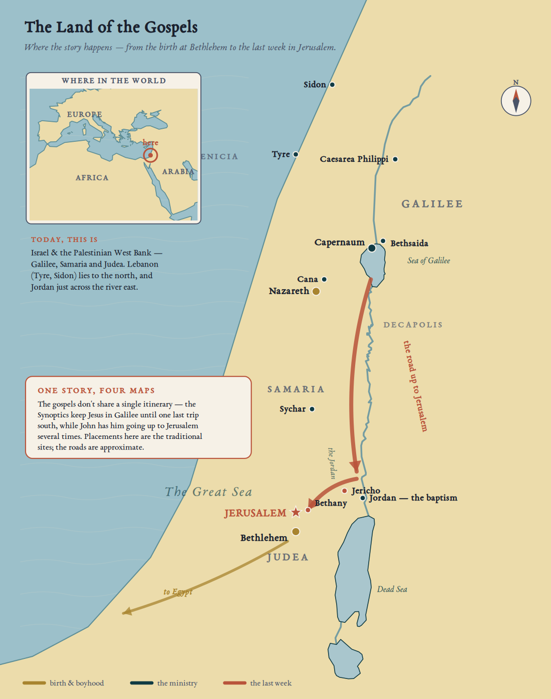
The gospels unfold in a small strip of land on the eastern shore of the Mediterranean: Galilee in the north, where Jesus grew up and taught; Samaria in the middle; and Judea in the south, around Jerusalem. The distances are short — a few days’ walk from the Sea of Galilee down to the city.
The four gospels do not share a single itinerary. The first three keep Jesus in Galilee until one last journey south; John has him going up to Jerusalem several times. So this map marks the traditional sites and colours them by phase of the life — birth, ministry, the last week — rather than drawing a route that would pretend to a precision the sources don’t give.
On a present-day map this is Israel and the Palestinian West Bank — Galilee in the north, Samaria in the middle, Judea and Jerusalem in the south — with Lebanon just above (Tyre and Sidon) and Jordan across the river to the east. The whole of it is smaller than many a single U.S. state; you could drive its length in an afternoon.